Urban morphology of central Helsinki
Why are the neighbourhoods even in the centre of Helsinki so different in their liveliness?
Analysis, Helsinki, 2017.
Conducted at the Urban Environment Division of the City of Helsinki.
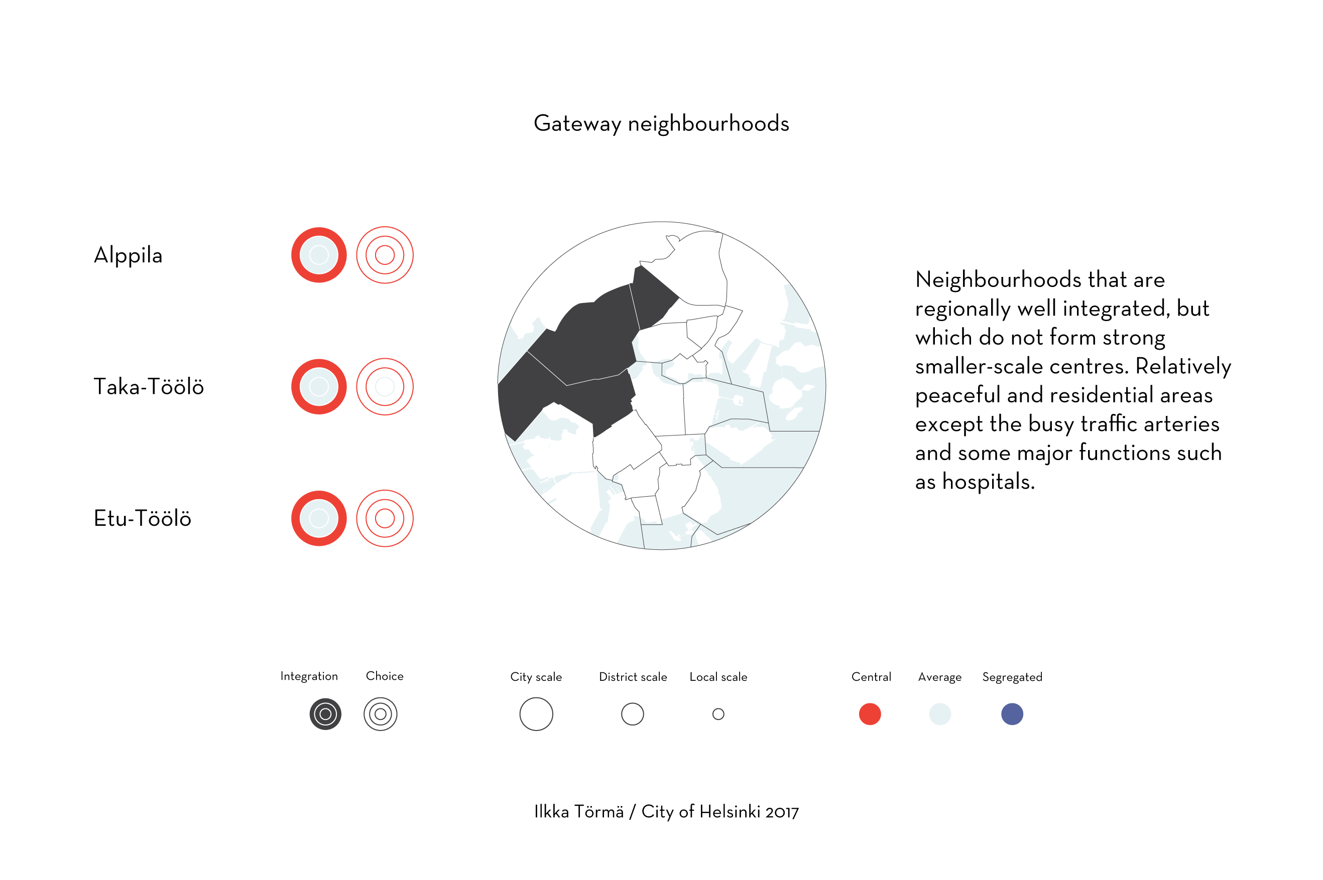
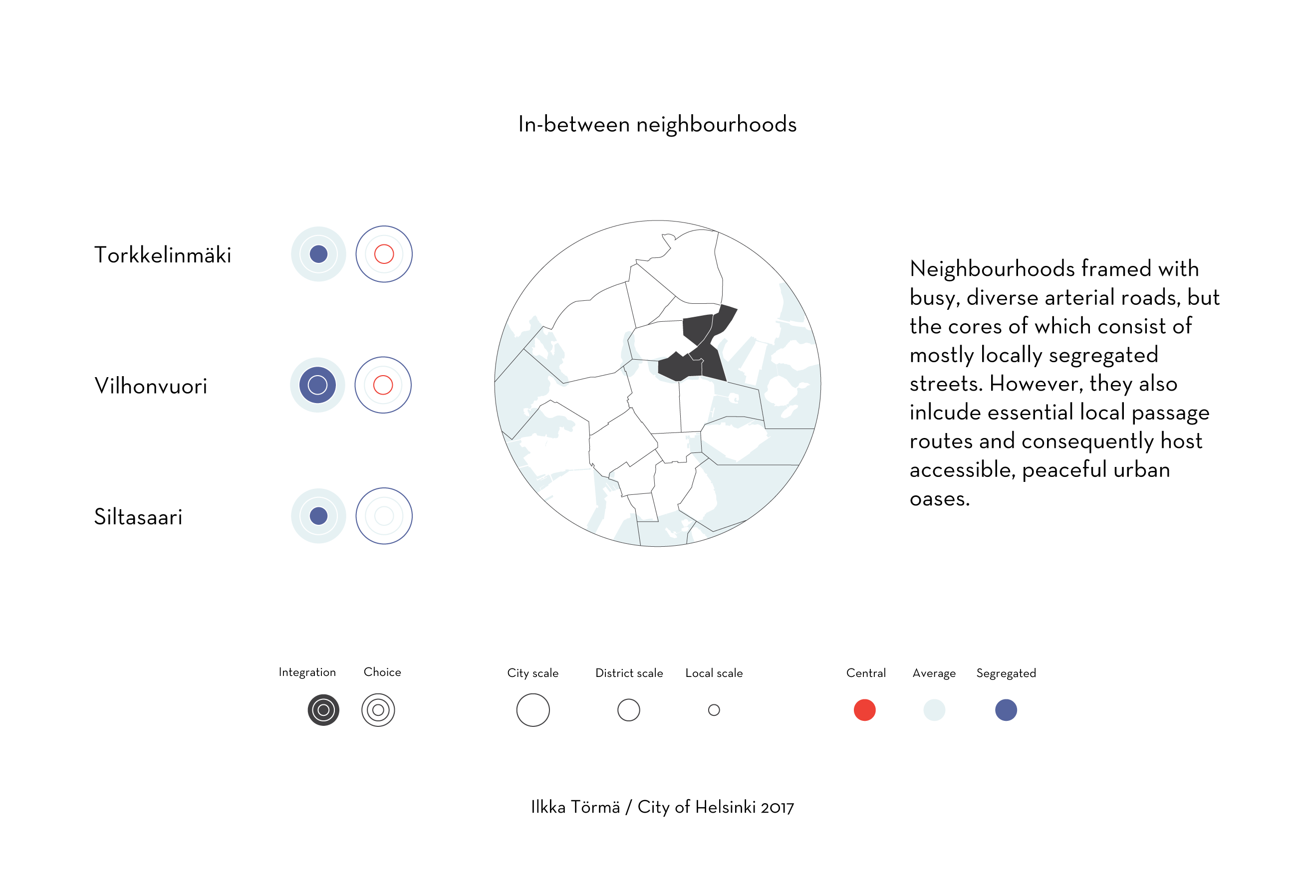
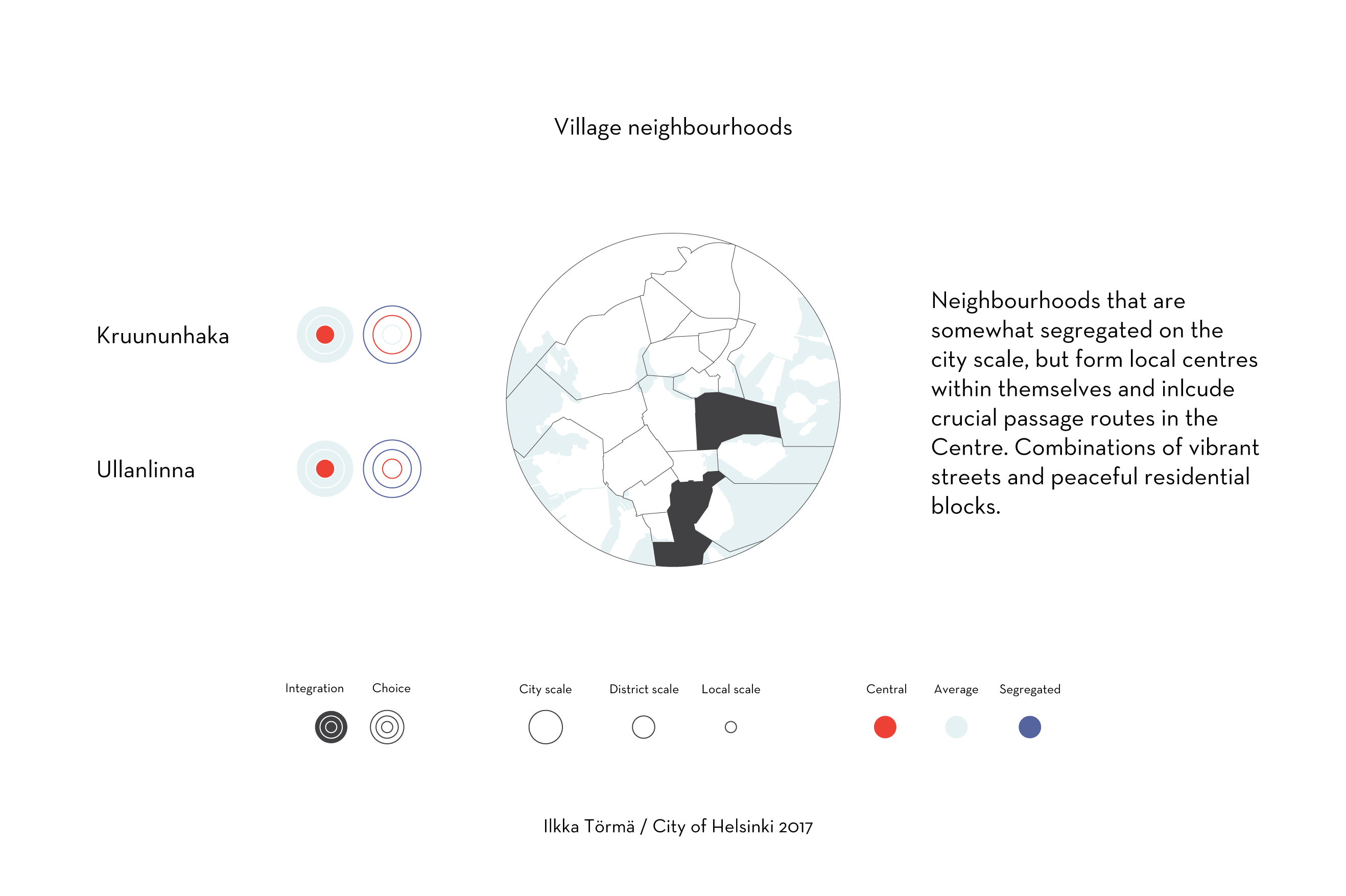
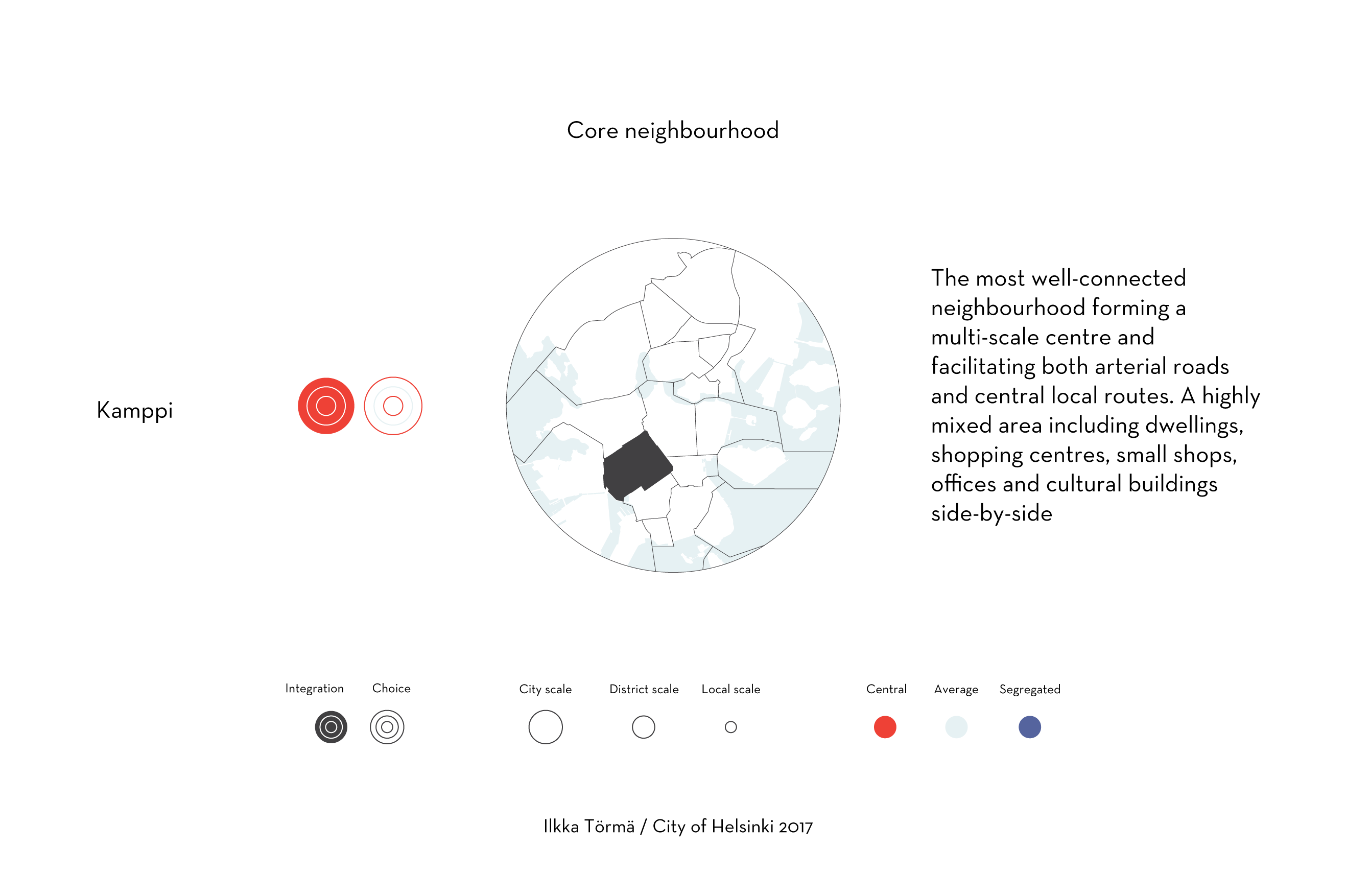
The analysis portrays spatial centralities and segregations in the street network of central Helsinki thus describing its urban morphology.
Based on the street network maps, the analysis characterises neighbourhoods, describing how they form regional, local or multi-scale centres. The work informs city planning of the differences in social character and the potentials of land use in the streets and neighbourhoods. For example, they help identifying places that can sustain diversity of land uses, because they show places that may potentially have passers-by both from the vicinity and farther away.